

I love it when I have a chance to hike a trail I’ve not been on before. It’s an added bonus in this day and age when I know that relatively few people at all have ever hiked that trail. Read about the Valles Caldera National Preserve in the Jemez Mountains of northern New New Mexico offers both kinds of experience owing to it only recently being opened for access to hikers.
This hike is about 8 miles (12.7 km) and I hiked it from east to west. The hike starts at about 8400 feet altitude (2558 m) and climbs 1635 feet (499 m) to a maximum altitude of 10,027 feet (3057 m) before a short descent to the pick-up point at the end of the hike.
 I arrived at the visitor center at the Valle Grande Staging Area at 8:20 in the morning following a pretty half-hour drive from Los Alamos. It was a crisp mid-May Friday morning … Spring hadn’t yet fully arrived at this altitude. I picked up information and paid my fee ($10) at the visitor center. I was the first customer for the back country shuttle that drives a loop through the Preserve, so I climbed into the van and got a quick ride to the trailhead which is one of the first stops on the loop. I picked this trail to minimize the time I would need to spend being driven around … it was a short drive to the start and I would end up at one of the later stops in the shuttle loop prior to its return to the visitor center (and my car). The hiking route is designated on the few signs you will see as VC0301.
Going in this direction, the hike is a steady climb for most of the way (6.7 miles) but gradual and never feeling that steep. The trail is an old logging road that is in excellent shape … very good footing. It is a highline trail that features big views in one direction or another nearly the entire distance. There are substantial burned areas throughout the hike owing to recent wildfires, but I find these interesting and/or beautiful in their own way. I would estimate that 60% of the hike was affected to various degrees by burns. Near its end, the trail passes beneath a summit known as Redondito … it’s kind of like a little brother to the larger Redondo Peak to the south. These peaks and the area around them are posted on Preserve maps as off-limits.
A view from the trail … the little dots in the foreground are cattle
 Colorful stump …

Spring flowers in bloom


Typical trail section — the trail is a former logging road

Highline view

I came across groups of elk at least a half dozen times and wild turkey once .. they were all too fast for my camera work to catch a clean look at …

… except for this one that didn’t survive the winter

Redondito Peak

Burnt Beauty – aspen grove on its way to being a meadow …


highline view to the north …

More flowers


Under Redondito Peak — steep rock fall on the North side of the peak

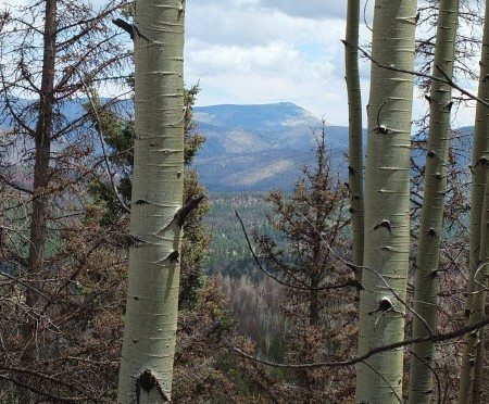
View of Santa Clara Peak from 10,000 feet

Van waiting to pick me up for return to my car — it took about an hour drive to get back from here

Prairie dog watchers near Redondo Meadow — believe it or not, someone mans these 5 viewing stands constantly to see and record what the prairie dogs are up to. They have been there watching for two years and still have five years to go during their current study. That’s dedication to your research!


Leave a Reply